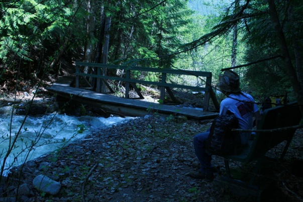
Skattebo Reach is a scenic riverside trail running 12 km along the east bank of the Kootenay River, connecting the Ootischenia/Brilliant area to the community of Glade. Built by Castlegar Parks and Trails Society volunteers about 20 years ago, it’s part of The Great Trail (the Trans Canada Trail) and of a longer vision to link Trail, Castlegar, and Nelson by a non-motorized route that stays off the highway.
Recently upgraded (2021–2025)
Skattebo Reach is no longer an expert-only ride. After a major three-phase upgrade completed in October 2025, the main section is far more bike-friendly and accessible to a wider range of ages and abilities. The work widened the trail, eased the steepest grades, removed the old steel waterline hoops from the path, and added two new aluminum bridges across McPhee and Little McPhee Creeks.
The roughly $304,000 project was made possible by the Trans Canada Trail, Kootenay Rockies Tourism, Columbia Basin Trust, the Regional District of Central Kootenay, and Athletic Brewing — along with the landowners, contractors, staff, and volunteers who saw it through.
Trail details
- Difficulty: Intermediate (hiking and biking)
- Distance: 12 km one-way (Brilliant Park & Pool to Glade)
- Elevation gain: ~60 m
- Dog friendly: Yes
- Bike friendly: Yes — the upgraded Brilliant Terminal Station–to–Glade section now suits intermediate cyclists (previously expert-only)
- Facilities: Pit toilets at the substation and the McPhee Canyon trailhead; benches along the route
- Season: Year-round
The trail
This long, sometimes rocky trail follows the Kootenay River all the way to Glade, with bridges over rushing creeks and cool forest that make it a pleasure even on a hot day. Along the way it links to the Dove Hill / Elk Cut-Off, Doukhobor Waterline, Brilliant Overlook, and McPhee Canyon trails.
Note to cyclists
Two short end sections were intentionally left in their natural state. The ~2 km at the south end, between the Brilliant Park & Pool and the Brilliant Terminal Station, is still rugged and steep — cyclists should bypass it by road and start at the Brilliant Terminal Station. The ~3 km at the north end near Glade follows an existing dirt road. As always, please give right-of-way to hikers.
Access
From the Brilliant Park and Pool (best for hikers)
- Leave Castlegar heading toward Nelson on Hwy 3A
- Just before the Brilliant bridge, turn left on Rosedale Road
- The Brilliant Park and Pool is the immediate right, bordering the highway
- Cyclists should start at the Brilliant Terminal Station instead
From the Brilliant Terminal Station parking lot (best for cyclists)
- Leave Castlegar heading toward Nelson on Hwy 3A
- Before the Brilliant bridge, turn right on Ootischenia Road and head up the hill
- Follow signs to the golf course; turn left on Corrigan Road, which becomes Columbia Road
- Turn left on Aaron Road
- Turn right on the McPhee gravel road with the gate (note gate closure times); follow for 4 km, keeping left at the fork
- Turn left into the parking lot before the substation
From Glade
- Head north on Hwy 3A toward Nelson
- Turn right after the lumber yard at the Glade Ferry sign
- Cross the Kootenay River on the Glade Ferry
- Take the first right on Glade Road
- Where the road turns to gravel, continue 2.7 km (may not always be fully driveable)
- Park at the glacial erratic (the large out-of-place rock on the right)